Publicado el 01-08-2014
Características de la ruta
Primera ascensión
Ruta: Normal
- Gustav Brant
- Rudolph Luck (los Incas ascendieron por esta ruta entre los siglos XV y XVI y probablemente mineros desconocidos también lo hicieron))
Entre noviembre y marzo. En primavera las condiciones del terreno presentan abundante nieve en la aproximación. La mejor época es en enero y marzo, donde la aproximación no presenta nieve, salvo algunas zonas específicas, y el tiempo es más estable.
Hay 3 accesos posibles para ascender las rutas de la cara oeste del Plomo: desde Valle Nevado, a través del cerro Tres Puntas (1); desde La Parva, a través del portezuelo y laguna de Piuquenes (2); o desde Cancha de Carreras, siguiendo el sendero que después de un expuesto acarreo, desciende hacia el refugio Federación, ubicado a los pies del cerro Plomo (3).
Para todas estas alternativas primero se debe llegar al poblado de Farellones.
Si se opta por la primera alternativa se deberán recorrer desde Farellones otros 14km (pavimentados) hacia el noreste hasta Valle Nevado. Una vez en el centro de esquí, donde quedan estacionados los vehículos, y luego de registrar en la entrada las personas que suben, el destino y la fecha de regreso, tomar caminos de tierra que se acerquen lo más posible al cerro Tres Puntas, al este de la zona de Tierras Bayas, en el sector de las canchas del centro invernal (3450m).
Si, alternativamente, se opta por la segunda opción, se debe tomar el mismo camino que conduce a Farellones, pero en vez de tomar la bifurcación hacia Valle Nevado, continuar 8km más por el mismo camino hasta el centro de esquí La Parva. Al final de éste, dependiendo de si el camino y el paso hacia las canchas estén habilitados, se debe alcanzar la base del andarivel Águilas, punto hasta donde se permite el ingreso de vehículos. Este acceso es común para la aproximación por Cancha de Carreras (ver descripciones de rutas normales de los cerros Leonera, La Parva y Pintor).
Solo durante temporada invernal hay transporte público a Valle Nevado y La Parva.
Desde Valle Nevado
Una vez en los pies del cerro Tres Puntas, iniciar la caminata que al comienzo se caracteriza por ser un descenso pronunciado por un sendero muy claro y ancho hasta el primer lugar de campamento llamado Piedra Numerada (3370m), ubicado en medio de una gran vega a orillas del río Molina. Este lugar es usado por los arrieros para contar los animales antes de bajarlos cuando llega el invierno. Es un área amplia, con abundante agua y lugares donde instalar campamento. Un conjunto de rocas y pircas sirven de referencia. Desde Tres Puntas son 1h a 2h hasta Piedra Numerada. Desde este campamento es posible ver el cerro Plomo hacia el final del valle.
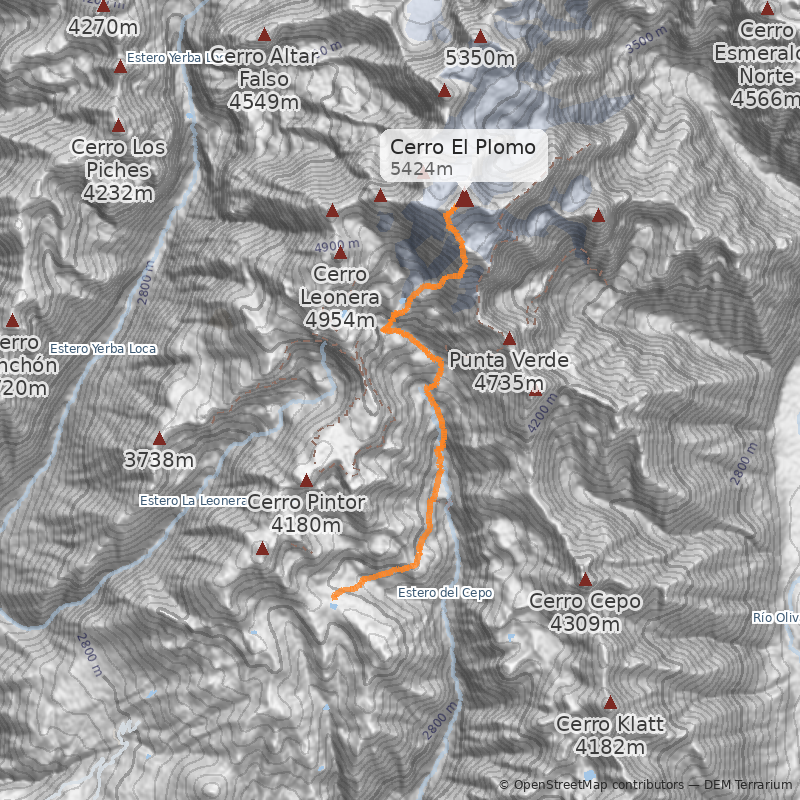
Una vez en Piedra Numerada se debe continuar hacia la Hoya, ubicado en la base del cerro Plomo. En su mayor parte la huella sigue el curso del río Molina, remontando al principio la caída de agua que se ve desde Piedra Numerada. Dentro de aprox. 4h debiera alcanzarse el lugar de campamento de la Hoya (4200m), aunque esto dependerá fuertemente de la capacidad de carga y de la aclimatación de los montañistas. La Hoya se encuentra justo después de subir un morro gris que se aprecia al frente de un refugio colorado (refugio Federación, apto para que duerman cómodamente unas 4 personas) que está a un costado del camino que va en dirección al Plomo. El lugar del refugio Federación (4100m) es lugar opcional de campamento, en el que hay además muchos sitios para la instalación de carpas. En él se asegura un buen descanso, que puede compensar el mayor esfuerzo del día de cumbre.
Desde portezuelo Piuquenes
Desde la base del andarivel Águilas, se deberá caminar en dirección este hasta alcanzar, luego de aprox. 2h-2½h (sin nieve), el portezuelo de Piuquenes. En temporada estival el andarivel funciona para excursionistas, lo que posibilita llegar en ¼h al portezuelo. El costo de una subida y la respectiva bajada es de aprox. $10000 (~US$12) p/p. El andarivel sólo funciona los fines de semana entre 9.00 AM a 5.00 PM.
Una vez en el portezuelo de Piuquenes (3470m), y luego de ascender las inmediaciones superiores de las pendientes del centro de esquí La Parva, seguir por el sendero que bordea por el costado sur la laguna de Piuquenes, internándose hacia el este y que luego de un par de ascensos y descensos llega a Piedra Numerada See photo 2. Este tramo requiere aprox. 2h a 3h.
Desde Piedra Numerada a la Hoya se sigue el mismo sendero descrito anteriormente.
Desde Cancha de Carreras
Una vez en el portezuelo de Piuquenes, ascender en dirección norte la Falsa Parva See photo 3. Esta parte toma menos de 1h, y transcurre por cualquiera de los derroteros que serpentean los distintos acarreos de la Falsa Parva (tanto por el lado oeste o este del cerro). Una vez alcanzada la cumbre de la Falsa Parva, seguir la huella marcada de muy suave inclinación que se dirige en dirección este hacia al cerro Plomo. Desde la Falsa Parva (3740m), en menos de 20 minutos se alcanza y comienza a rodear el cerro La Parva (3970m), que se ve al costado derecho (sur) del camino. Luego viene el cerro Pintor (4220m), bordeando por la izquierda (norte) su cumbre, que se encuentra a escasos metros. En total, desde el portezuelo hasta el cerro Pintor, se requieren entre 2h a 3h en promedio. Desde el Pintor se baja hacia una extensa y abierta explanada conocida como Cancha de Carreras. Justo en el medio de esta planicie corre un tímido curso de agua. Después de pasar el desfiladero rocoso que viene inmediatamente después de Cancha de Carreras, nace a la derecha (este) un sendero que entre acarreos baja hasta el campamento Federación, ubicado al pie de la corta pendiente que conduce a la Hoya.
Campamento Federación o La Hoya (4200)
La Hoya es un plano arenoso que se encuentra a escasos metros del glaciar Iver del Plomo (incluso, en años muy nevados, el glaciar avanza tanto que en ocasiones cubre por completo el lugar de la Hoya; ej: verano 2002-2003) y se encuentra 100m más arriba del campamento junto al refugio Federación. Es un lugar relativamente protegido del viento, aunque muy punero See photo 5. Otros lugares donde acampar son "Los Espejos" y el refugio de Agostini. El primero se encuentra a aproximadamente 15-20 minutos de La Hoya siguiendo la huella que va hacia la cumbre. En medio de un sector de piedras son visibles dos lagunitas o pozos de agua muy prístinas. El lugar es bueno porque es protegido del viento, es más solitario, y según algunos estudios aislados es menos punero que La Hoya. El refugio de Agostini es un modesto refugio de madera que se encuentra al pie del acarreo principal del Plomo (construido por la Federación de Andinismo en los años 60) See photo 6. Ubicado a unos 4600m, el refugio de Agostini es expuesto a los vientos, y no tiene agua disponible, aunque hay nieve para derretir. Las dimensiones de la construcción alcanzan a albergar adentro a una carpa baja para tres personas. Es fundamental la decisión sobre cuál de estos lugares elegir para descansar la noche previa al ataque a la cumbre. El trabajo necesario para llegar con todas las provisiones al lugar del refugio, por ejemplo, no siempre es proporcionalmente compensado por un ahorro de tiempo en el ataque a la cumbre; esto dependerá fuertemente de las capacidades de los montañistas. Con carga, de La Hoya al refugio puede tomar más de 1½h. La misma distancia es recorrida en aproximadamente la mitad del tiempo en una jornada normal de cumbre. Para quienes disfrutan socializar, se recomienda Federación. Para quienes prefieren lugares más solitarios, se recomienda Los Espejos. Los montañistas que se están entrenando debieran ir al refugio. Para los que son muy sensibles a la puna, se recomienda el campamento de Federación.
Ascenso a la cumbre
Desde La Hoya volver hacia el camino que une este campamento con el de Federación y tomar la huella que remonta el promontorio que protege el lugar de La Hoya girando hacia el Plomo (en forma de hoz). La huella se dirige hacia el este hasta Los Espejos, lugar donde el camino gira en dirección hacia el glaciar Iver (dirección norte) rodeando desde arriba la zona de La Hoya, siempre visible. Luego se alcanza el plateau donde está el refugio. Desde ese punto (lugar óptimo para la hidratación y descanso) comienza un largo acarreo.
El acarreo del Plomo
Varios senderos sinuosos llegan por distintas vías (en muchos puntos se cruzan) hasta unas torrecillas de roca, visibles desde todas partes, y que marcan el final del acarreo. La ruta más tradicional (con menos pendiente y mayor adherencia) consiste en rodear el sector de rocas por el lado este (en sentido contrario del glaciar del Plomo; por la derecha). Luego de alcanzar este punto, es necesario hacer travesía por encima del glaciar Iver del Plomo, por una huella de piedras grandes. Esta travesía culmina en el lomo del Plomo. Unos pocos minutos más se requieren para llegar al cruce superior del glaciar del Plomo. Sobre un domo de piedra hay una pirca de piedra que protege del viento y sirve de descanso, desde aquí pueden apreciarse los glaciares más septentrionales del cerro y por primera vez convencerse que el Leonera ha quedado más abajo See photo 7. Antiguamente este era el lugar para ponerse los crampones antes de iniciar la travesía del glaciar See photo 8, sin embargo, debido al calentamiento global el glaciar ha retrocedido en esta parte del cerro y la ruta ya no pasa por él See photo 9.
La travesía del glaciar, que actualmente se realiza por una huella sobre acarreo, presenta poca pendiente y se mantenía libre de grietas (el cruce del glaciar tomaba entre 15 y 30 minutos en su parte más angosta un año normal) See photo 8. Sin embargo, el hielo solía ser duro por lo que era bueno usar crampones y tener extremo cuidado: se requerían pocos metros de deslizamiento para llegar al punto donde la pendiente pasa a ser extremadamente abrupta, con más de 600m de desnivel de caída.
Una vez cruzada la zona donde se encontraba el glaciar, se requiere de menos de 1h para alcanzar la cumbre, después de sortear acarreos sueltos de piedra en medio de las torrecillas de la cumbre.
La cumbre
Desde La Hoya se requieren entre 4h y 8h de trabajo para llegar a la cumbre, variando mucho según el clima y las condiciones de los expedicionarios. Una buen parámetro son 6h desde La Hoya. La bajada dura aproximadamente la mitad de lo que dura la subida, aunque es determinante el efecto de la puna.
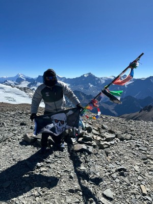
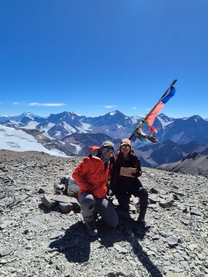
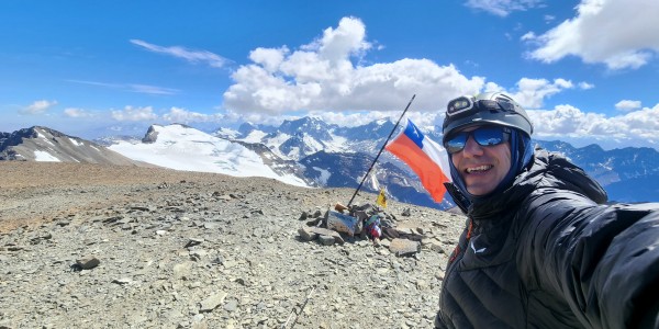
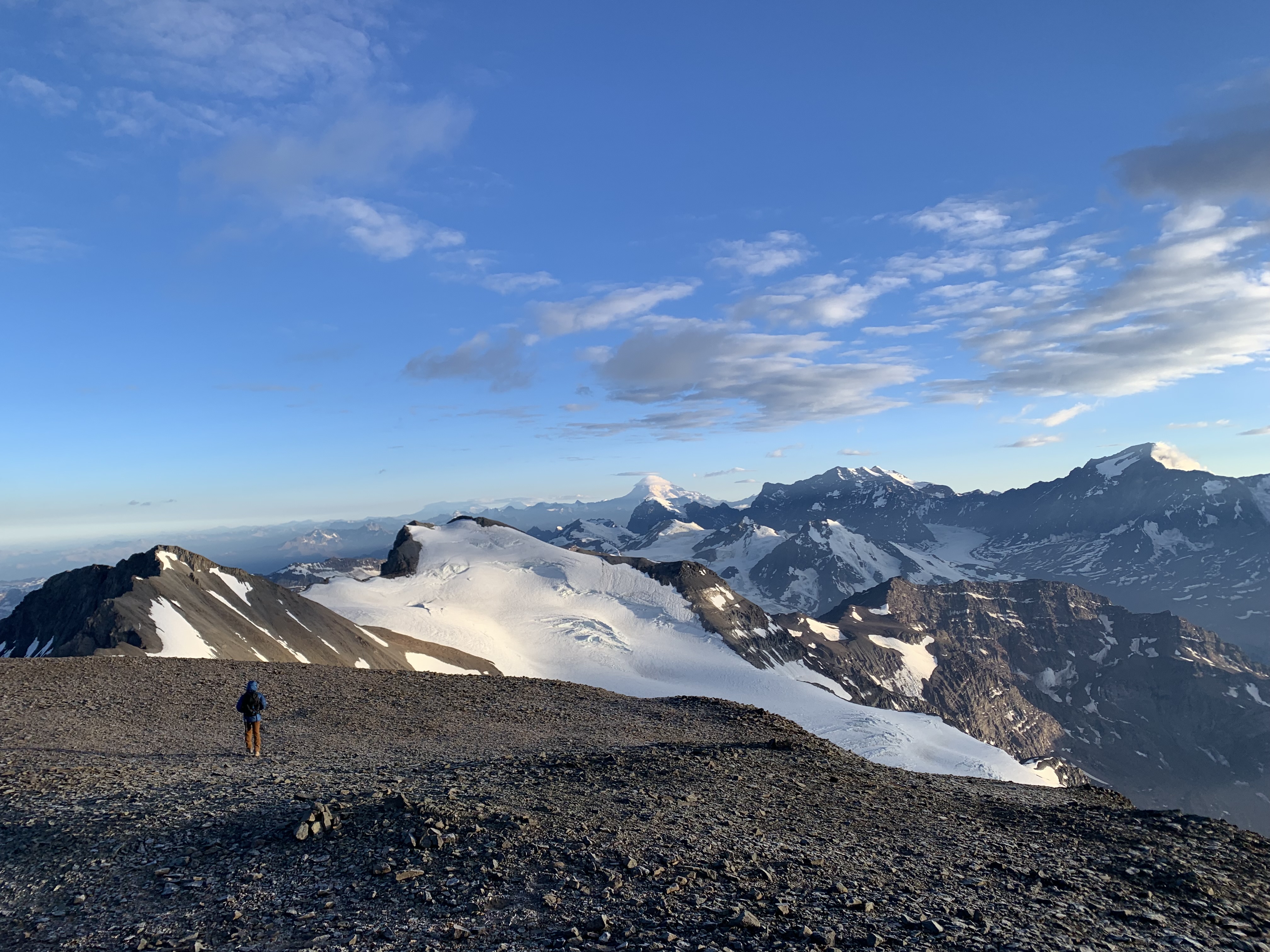
La cumbre de este clásico cerro de la zona central es un espectáculo: desde ella se dominan todas las altas cumbres de la zona central, desde el Mercedario, que está a la altura de La Ligua hacia el norte, hasta el volcán Maipo, a la altura de Rancagua See photo 10. La cumbre es extensa, y demora un par de minutos cruzarla hasta el punto más alto, indicado por una cruz y el memorial al fallecido montañista de la primera expedición chilena al Everest, Víctor Trujillo. La cumbre es generalmente azotada fuertemente por el Bóreas y la sensación térmica es muy baja, a no ser que uno se proteja del viento.
- Llevar muy buen equipo
- Hidratarse continuamente
- El ataque a la cumbre deberá comenzar muy temprano (salir no más allá de las 6 am). Esto porque en verano es muy común que se produzca borrasca alrededor del mediodía, con probable tormenta eléctrica. Por eso se recomienda alcanzar la cumbre no más allá de las 12.00 AM, y antes si el tiempo lo indica. La cumbre del Plomo no es un lugar muy seguro donde permanecer
- Posibilidad de arrendar mulas, hablar con el Sr. Luis Orlando Polanco (F:3216515; 908 73117), quien vive entre el puente Corral Quemado y la curva 1 del camino a Farellones (tiene un letrero al lado del almacén que está antes de la curva 1). También se puede hablar con Mauricio Polanco (F: 820 10098) quien arrienda caballos y mulas a $15.000 por animal/día.
- Se recomienda avisar de la salida al Cuerpo de Socorro Andino. Se puede hacer a través del formulario en su página web.
- Abrigo y calzado apropiado para alta montaña.
- Equipo de campamento
Itinerario Normal
- Santiago - Piedra Numerada
- Piedra Numerada - La Hoya o Federación
- La Hoya o Federación - Cumbre - Santiago
Lo tradicional es partir un viernes en la noche para llegar a Piedra Numerada. El sábado y domingo entregan tiempo necesario para hacer cumbre y volver a Santiago. Algunos ascienden el Plomo durante el día.
Itinerario Alternativo
- Santiago - Piedra Numerada
- Piedra Numerada - La Hoya o Federación
- La Hoya o Federación - Cumbre - Piedra Numerada
- Piedra Numerada - Santiago
Este es el itinerario óptimo considerando la aclimatación.

